Schedule a free consultation Let’s Go
Success Story
Monitoring Uranium Storage Facilities
Mission Objectives
The US Department of Energy was looking for ways to improve their management of legacy uranium sites. The objective was to create a program that would allow the structures on the sites to be modeled in detail. The models needed to be spatially accurate so future models could be compared, and changes detected. Because the sites are sensitive critical infrastructure, data security would be extremely important. Additionally, the safety standards on these sites are exceptional, so any procedures would need to take that into account.

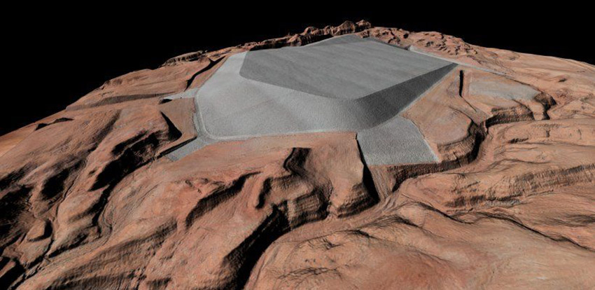
A digital surface model of LM’s Mexican Hat, Utah, Disposal Site combines Lidar (laser-based radar) and aerial imagery to generate a three-dimensional surface. Photo Credit: Office of Legacy Management.
The Solution
Juniper Unmanned developed a novel way to fuse a highly dense LiDAR point cloud with high resolution imagery. We established survey standards and monumented the sites, allowing the data to be collected with an absolute accuracy. The team also collaborated closely with the Department of Energy Aviation office to develop standards and procedures for conducting unmanned aircraft flights on site, including establishing geo-fences around the perimeter of the sites. We integrated the LiDAR onto US made Unmanned Aircraft and established a supply chain for future maintenance and scaling requirements. Juniper was asked to perform the continuing data acquisition and data processing. We built training content and developed the internal capacity to support the program at scale.
