Schedule a free consultation Let’s Go
The Effectiveness of Drone-Based LiDAR
December 23, 2016
Aerial LiDAR surveys have become a mainstay on most worksites in mining, oil & gas, and heavy construction. LiDAR is making improvements in terrain mapping and growing in popularity for hydrology, geomorphology, site planning, landscape ecology, and volumetric calculations. By producing highly accurate elevation data through vegetation in the day or night, LiDAR offers several advantages over traditional methods for aerial mapping. Improvements in the technology, and reductions in the prices for acquisition, since its commercial introduction nearly 20 years ago, has made LiDAR more accessible. And as sensor companies look for ongoing improvements and cost reductions, the drone, or unmanned aircraft, may offer the next breakthrough.
To evaluate the effectiveness of drone-based LiDAR technologies, Juniper Unmanned conducted an empirical study at its testing facility in Colorado in August, 2016. The objective of the study was twofold. The first aim was to determine the spatial accuracy and point cloud density of the data and compare it with a manned data collection. Secondly, the company wanted to compare the data workflows and the cost of the unmanned solution against those of a LiDAR acquisition with a fixed-wing airplane.
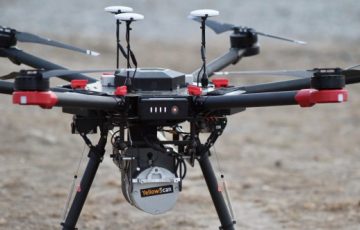
To begin, Juniper established a dense set of photo-identifiable markers in the 3,500-acre area of interest. Next, a manned aircraft flew over the site and simultaneously acquired orthophotos and LiDAR with state-of-the-art aerial imaging systems. Next, the company flew over the smaller portion of the area of interest with the Yellowscan Surveyor LiDAR integrated on a Pulse Vapor 55 unmanned helicopter. Both data sets were then processed and the data checked against the locations of the photoidentifiable markers.
The data collected with the manned aircraft produced 1.5 points per square meter with a RMSE (root mean square error) of 3.5 centimeters. The data collected from the unmanned system produced 150 points per square meter with an error of 2.4 centimeters. The process of conducting the survey with the manned aircraft required several weeks from the time the flight was ordered to the time it was conducted. Data processing required an additional three weeks. The typical price for this kind of aerial survey is approximately $50,000. That price would not decrease much for a smaller area, as the cost of the flight is fixed. To get the best value per acre, manned flights need to acquire large areas.
The process of conducting the survey with the drone required 3 days of preparation and the data was processed in the field. The price for the LiDAR acquisition with the drone is approximately $8,000 to $10,000 for an area no more than 500 acres. Depending on the aircraft, that is about the maximum area that can be acquired in a day of operation. Additional days will increase the price by about $3,000 per day.
Acquiring LiDAR over the small area was far more cost effective with the unmanned aircraft, while the larger area is more efficiently collected with the manned aircraft. Therefore, the effectiveness of using a drone for LiDAR collection depends on the project requirements. In small project areas it is hard to imagine a situation where the drone is not the best option. Likewise, it is a useful tool for projects where higher point cloud densities are needed, or the data needs to be available rapidly. The UAV can be deployed rapidly and generate reliable data for a lower total cost in these situations.
It is important to note that not every LiDAR unit available on the market was tested here. The technologies are not all the same and results will vary widely. If you are hiring a service provider, be sure to look for their technical experience with LiDAR. Results depend on the pilot’s experience with collecting data of this type. Service providers should be able to meet operational covenants including aviation liability insurance, operator proficiency standards, airworthiness of the aircraft, and safety procedures.
LiDAR from a drone can play a significant role on worksites. For some applications, the data provides a real advantage at a price point that is substantially lower than the alternatives.
Juniper Unmanned (http://juniperunmanned.com) is a private technology company based in Golden, Colorado. Juniper’s goal is to enhance the UAS capabilities of the commercial enterprise. Juniper provides clients with operations management based on a standard protocol so they can realize the full benefit of the technology.